GAF AG
Booth number: R 30-10
www.gaf.de
About us
GAF AG (GAF) is an e-GEOS (Telespazio/ASI) company located in Munich and Neustrelitz, Germany. It is one of the leading geoinformation service providers in Europe in the area of earth observation with broad expertise in international consulting and technical development cooperation.
GAF’s key solutions for the mining sector include the mapping and interpretation of geological data, technical and institutional consulting for government bodies, and comprehensive management systems for Geological Surveys, Mining Cadastres, and Mines Inspectorates. These solutions are supplemented by a wide range of technical services, including fast and uncomplicated access to satellite data, AI-based processes, and advanced analytics — serving both governments and industry. In addition, GAF also provides services for public and private clients in areas such as land monitoring, natural resource management, agriculture and forestry, emergency mapping, and infrastructure security.
Address
Arnulfstr. 199
80634 Munich
Germany
E-mail: communication@gaf.de
Phone: +49 89 1215280
Internet: www.gaf.de
Contact person:
Tracy Haydn
Marketing & Communication
E-mail: communication@gaf.de
Antje Küpper
Unit Manager Consulting and Technical Assistance
E-mail: antje.kuepper@gaf.de
Thomas Weissmann
Group Manager Mining Cadastre
E-mail: thomas.weissmann@gaf.de
Products & Services
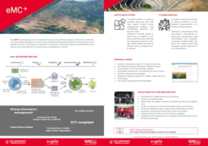
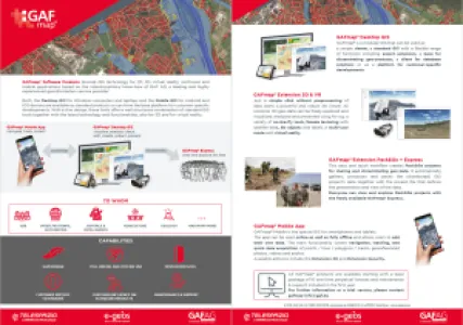
eMC+
eMC+ is GAF AG’s framework for providing Mining Cadastre authorities worldwide with a complete package of services and a platform tailored to the specific requirements of the cadastre domain. eMC+ makes it possible to increase institutional capacities and efficiency by delivering comprehensive mineral tenure management solutions.
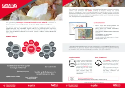
GeMinIS
The GeMinIS platform is an enterprise natural resources management solution, which is scalable and open with confi gurable business rules. It is an integrated system with built-in GIS functionality based on open-source libraries and is free of any vendor lock-in or licencing costs. Data exchange with a range of information systems is enabled through standardised web-services.
GAFmap (R)
GAFmap® Software Products provide GIS technology for 2D, 3D, virtual reality, multi-user and mobile applications based on the interdisciplinary know-how of GAF AG, a leading and highly experienced geoinformation service provider.
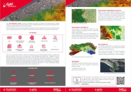
GAF Elevation Suite
The GAF Elevation Suite provides extremely accurate very-high and high-resolution digital elevation models and 3D models based on GAF AG‘s longstanding know-how, as one of Europe’s most experienced geoinformation service providers.
GAF’s elevation products are reproducible, reliable and can be generated for areas anywhere in the world. These products are fully quality controlled and can be tailored to customer requirements.
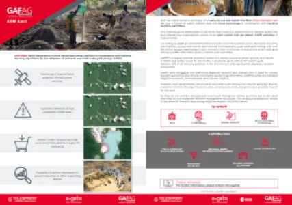
ASM Alert
GAF AG has developed and implemented an easy-to-use web-based system to recognise indications of unlicenced artisanal and small-scale mining (ASM) in tropical forests – the “ASM Alert” platform.
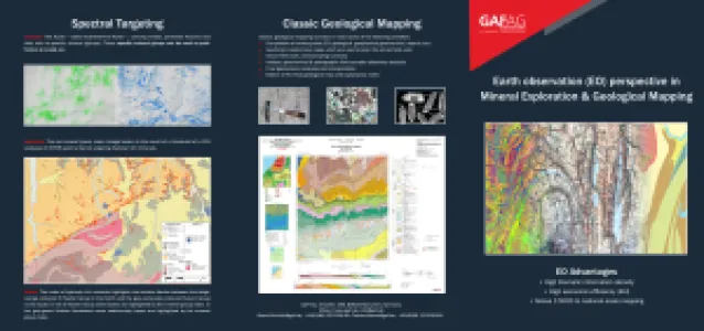
Mineral Exploration & Geological Mapping
EO Advantages
• High thematic information density
• High economic efficiency (RoI)
• Allows 1:5000 to national scale mapping